


.jpg&w=1400&h=470&zc=1&s=1)
Travel story North-Line Expedition Greenland


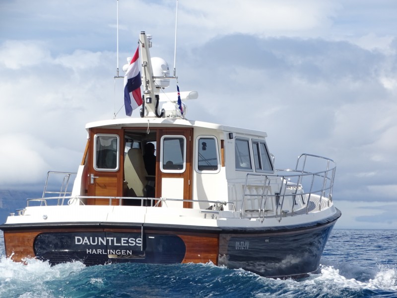


Read the complete story of the North-Line 42 Dauntless to Greenland.
10 June 2016 Harlingen – Peterhead, 375 miles, calm weather, rainy
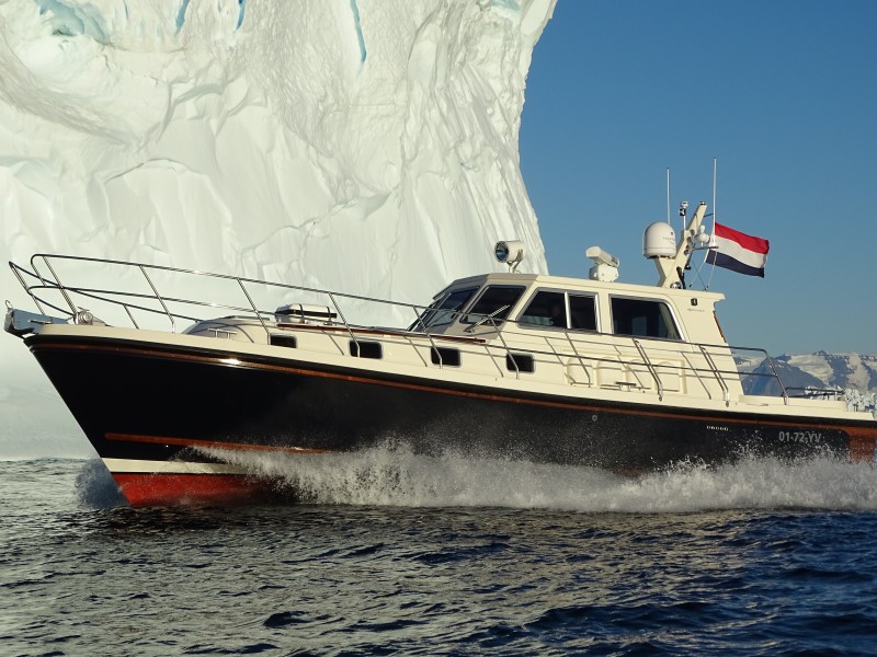
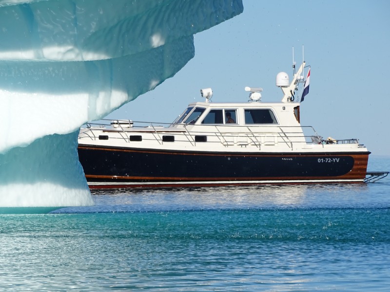
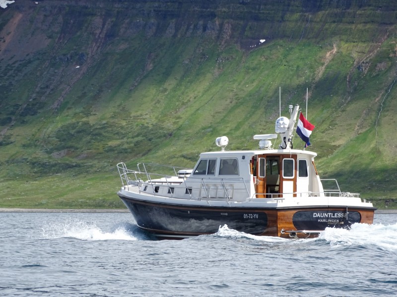
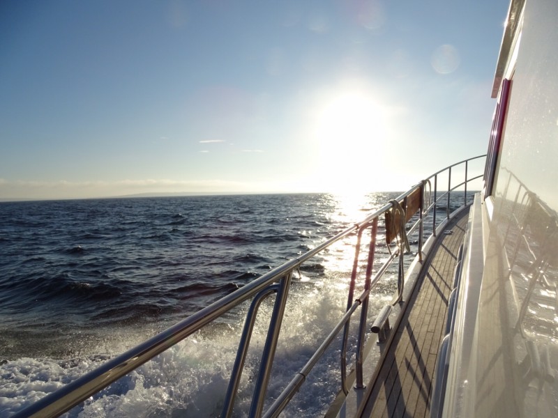
It is six in the evening when we wave goodbye to our family and friends on the quay and set off through the Tjerk Hiddes lock in Harlingen. What started as a dream around a quarter of a century ago is finally happening – I am off to Greenland! And we hope to also set a new record by being the first semi-displacement boat to motor there from the Netherlands while only fuelling en route
With a lump in our throats we leave the mainland behind and, with a steady speed of ten knots, are soon north of Vlieland island. Eventually it is time for ‘chef’ Cees to serve up the first dinner which, as will be the case on many occasions during the trip ahead, tastes delicious.
We’re surrounded by countless boats as the island of Terschelling is currently hosting the popular Oerol festival. Various sailyachts are overtaken before, leaving Stortemelk, we set out on course 315 to Peterhead. Accelerating to 2350 rpm we reach speeds in excess of 17 knots while carefully monitoring the Windfinder. Average waves of one metre were forecast but the reality is at least twice as high, and the yacht constantly rises and falls. We expect the waves to reduce after we enter deeper waters but, alas, it doesn’t calm down until the early morning. We don’t spot a single vessel during the night – no AIS signal on the plotter, not a dot on the radar. With light rain and a dark night we decide we can leave the window wipers turned off; we wouldn’t be able to see anything anyway as there is no moon and the sky is full of heavy clouds.
Our ETA in Peterhead is 15.00 and we report to port control five minutes before arrival. Asked what we are doing here, we reply that we have come to spend the night in the marina. A friendly harbour master asks where we are from: ‘Harlingen’ we answer, so he asks us to bring our passports to his office. First we perform a few necessary tasks, clean up and take a shower. The shower seems to wake me up and I start wondering whether I’ve even brought my passport with me. There is the moment when I realise where I left it… At home, in a drawer. Yup, after spending so many weeks preparing for this trip, I forget my own passport!
A quick phone call home makes clear that a courier will cost me 700 euros – not the best of news. Another option is to fly back home, but that’s not much cheaper. After a brief discussion we decide to go to the harbour master first. He doesn’t foresee any problems. After all, we’re only here to fill up with fuel and tomorrow we leave for the Faeroes. This gives my family at home time to send the passport to Tórshavn via DHL. To be honest we don’t expect the Customs people will send us back.
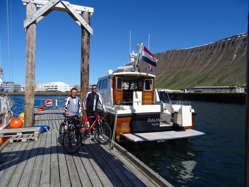
Feeling sporty, we grab our mountain bikes before dinner for a tour around Peterhead. It’s a dreary place where the youth hang around in doorways. We quickly head back to the boat where fresh sea bass is being served up by Cees, followed by a delicious dessert. Although the rain continues to fall, we remain positive. At least we don’t have to clean the boat: the salt washes away automatically. We briefly discuss tomorrow’s trajectory before heading for bed.
12 June 2016, Peterhead – Vagúr (Faeroe Islands), 297 miles, bright spells, some sun
After a hearty breakfast we return the gate key to the harbour master who says we can refuel in around ten minutes. We prepare the boat and sail to the fuel jetty where the harbour master drops down the hose from a five-metre quay with a smile. Our patience is sorely tested as refuelling is extremely slow and we have to return to the harbour to pay because: “My wire’s not long enough!” The Scots always did have a good sense of humour. After refilling the water supplies as well we’re finally ready for departure.
There are three hours of ebb tide remaining and we sail along at 1150 rpm and nine knots Everything is going smoothly: the weather is clearing up and we see a faint hint of sunshine in the sky. As there is so little traffic on the water, we set the radar alarm and get our chairs from the lockers; sailing can be so relaxing. In the meantime we repair a puncture on one of the mountain bike tyres – there’s more than enough space on board.
After 30 miles the tide starts turning and our speed falls to seven knots. We chug along slowly – there are around 750 songs left on the iPod so that should get us quite a way! After a warm meal we enter Pentland Firth. The AIS indicates that the Holland is heading in the opposite directions. Because we know the engineer on board, we call them on the VHF and switch to channel 77. We ask the Captain to pass on greetings from the crew of Dauntless.
Staying on course we exit the Pentland Firth at 20 knots around 21.00. At 21.30 we change our course to Vagúr. The wind increases to 18 knots from the East during the night. The swell is pleasant, the moon softly lights our way and all is well. During the night we pass a fishing boat and a small cargo vessel – but it’s quiet on the water as we take turns keeping watch.
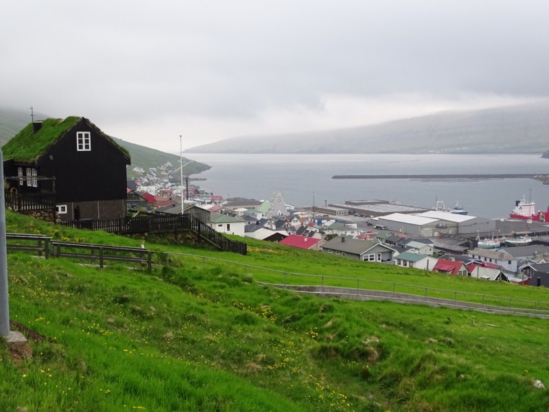
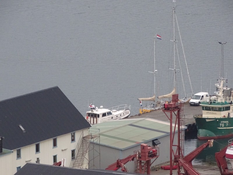
At eight in the morning we catch sight of the island and moor the yacht at the quay around nine. Luckily, we find ourselves beside Dutch neighbours who offer us a coffee. In the harbour master’s office we’re asked to fill out the crew list and told that we should be on board at 16.00 to receive the Customs authorities. This gives us time to go cycling but the weather isn’t playing along. With the constant drizzle it doesn’t take long before we are soaked through. A warm shower and coffee back on board are a godsend.
We decide to visit the fish market to get some fresh cod. We don’t know if it is our friendly (or athletic?) appearance, but we’re given the fish free of charge. The rest of our meal is purchased from the supermarket. Customs arrive and perform the first checks; crew list: check; alcoholic beverages: check; signature: check; calculator: check. Again we appear to have a positive aura: the papers and calculator are put away and, after a quick tour of the boat, we’re wished bon voyage. This makes the cod taste even better and after an evening stroll, some coffee and a glass of whisky we head for the bunks.
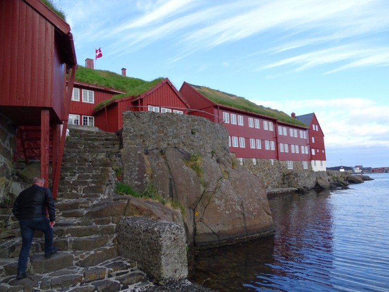
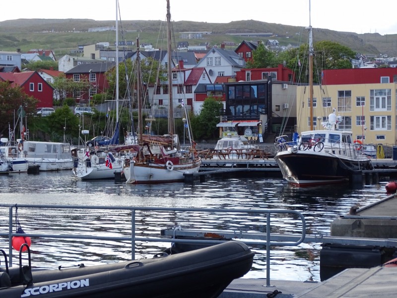
14 June 2016, Vagúr – Tórshavn, 36 miles, warm
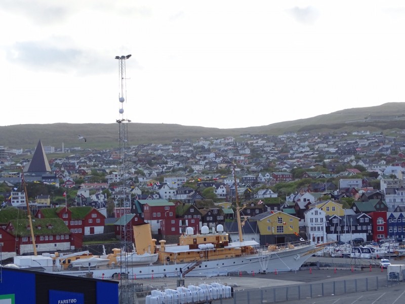
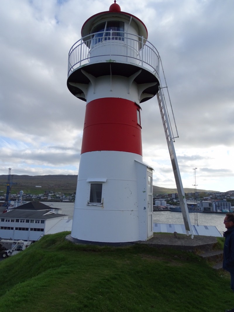
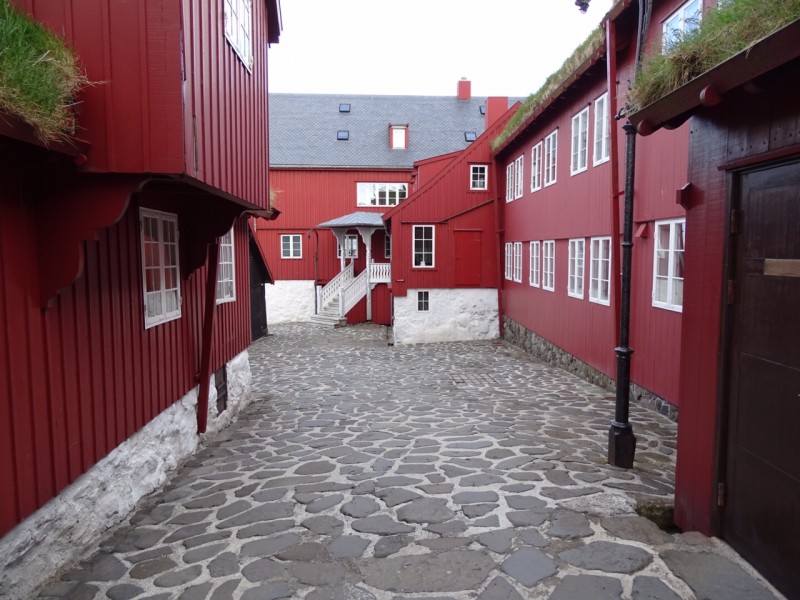
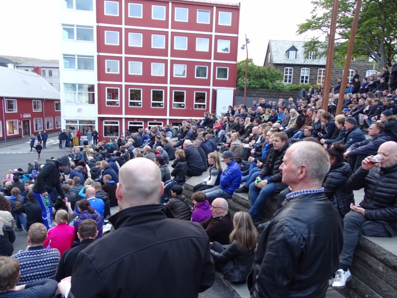
Today we’re up bright and early to a breakfast of bacon, eggs and coffee. After visiting the harbour master we untie the yacht at 11.00. The wind comes from the east and is around 12 to 15 knots. After two hours of mooring we lose the wind near the isle of Nolson and switch off the engine. It is time to use our fishing rods and try to catch some fish while floating on the current. Two hours pass by and we’re so bored that we restart the engine and head for Tórshavn, where we moor in the so-called ‘visitors box’. At night we join the locals to watch the football match between Portugal and Iceland on a big screen in the main square. Although it’s an exceptionally warm night, we decide to head inside with a beer and go to bed early. Tomorrow is a cycling day.
15 June 2016, Tórshavn, windy
Streymoy
The salt needs removing from the boat, a task which takes me a little under an hour. Then it’s time to explore the isle of Streymoy on two wheels. Finding the road leading north is not easy and we take several wrong turns. Once we do find the right road it quickly becomes pretty steep and the legs have to work hard. For a brief moment we feel like cyclists in the Tour de France, dreaming of winning the yellow jersey.
We come across a small town halfway, a perfect place for lunch, or so we think. Unfortunately there’s nothing available, and with rumbling stomachs and just a few snacks in our pockets we turn around. Thankfully we find a local supermarket inside the petrol station and the friendly attendant warms up our pizza rolls in the microwave. They taste great!
Our trip back is intense, the wind has increased and even going downhill we have to peddle with all our might. But with an average speed of 30 kilometres an hour, we can be pleased with our performance. Dinner is a quick affair: meat on the barbecue with some potatoes and mixed veg. We eat in the cockpit and see a Norwegian sailor enter the harbour in a wooden Colin Archer. It doesn’t look like the boat’s had much maintenance in the past 20 years, but the owner doesn’t seem to mind. The end of the day has come, and we are in bed by 22.30.
16 June 2016, Tórshavn – Seydisfjordur, 292 miles, variable weather
17 June: þjóðhátið – a major holiday on sautjándi júní celebrating the fact that Iceland became a republic on 17 June 1944 (source: Wikipedia)
The box beside us is empty when we wake up: our Norwegian neighbour left early. After paying the harbour master, preparing everything on board and refuelling, we’re ready to depart at 11.00. The first part along the coast sees us bouncing on the heavy waves. After ten miles we find ourselves between the islands again and the ocean calms. At a speed of four knots we throw out a line and hope to make a catch. Just in case we eat a meal prepared the day before: rice with goulash. The tide turns and we sail with the current. We increase our speed to 16/17 knots and before long are above the islands with a heavy swell and a 12-knot wind.
As we continue the weather softens. We sit in the cockpit sheltered from the wind, but it’s not all that comfortable and we have to keep a good look out. After 85 miles we come across a fishing vessel less than five miles away. There’s another 200 miles to go yet and you start to lose your sense of day and night: the light around us is intense. We take turns sleeping a few hours. The heating on board is turned on, it’s chilly outside. At four we tie up to a car-tyre-clad quay and are amazed by the sound of silence. We’ll have no trouble sleeping here.
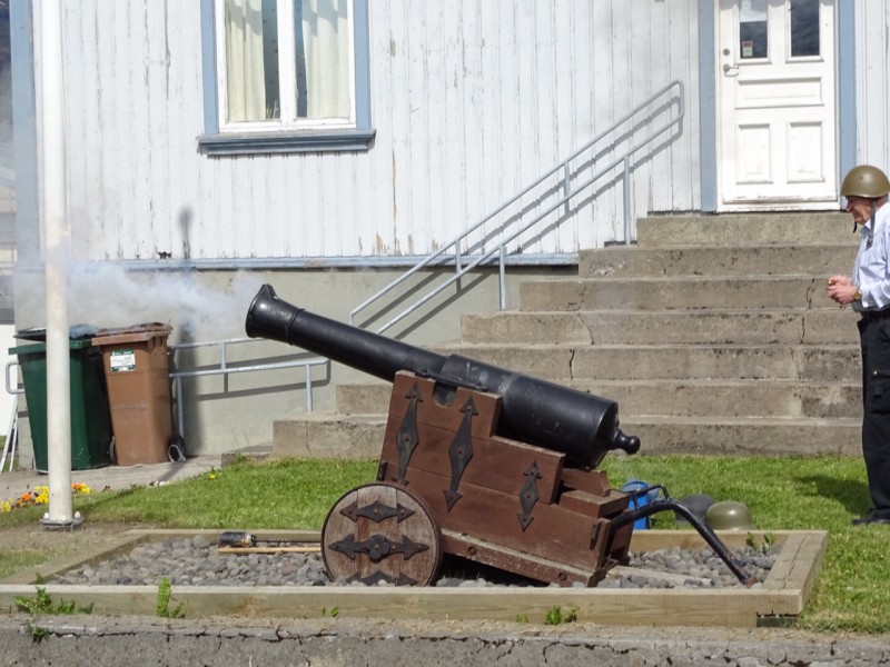
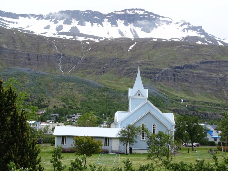
The next morning at 10.00 we hear that it is a national holiday (17 June) and that tradition dictates the firing of a cannon... One which seems to be is aimed at our yacht! We explore the centre of village, which is tiny with only a local supermarket, a few art shops and two cafés. At 14.00 everyone heads to the cannon. An old man tamps down the powder with a long stick and several paper balls disappear into the barrel. With a wide grin – the chap is clearly enjoying himself – he puts on a helmet, puts in his earplugs and asks us all to step aside. The blast that follows is loud, and that’s that. The locals slowly move off to the church to continue the festivities.
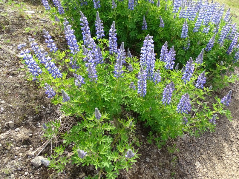
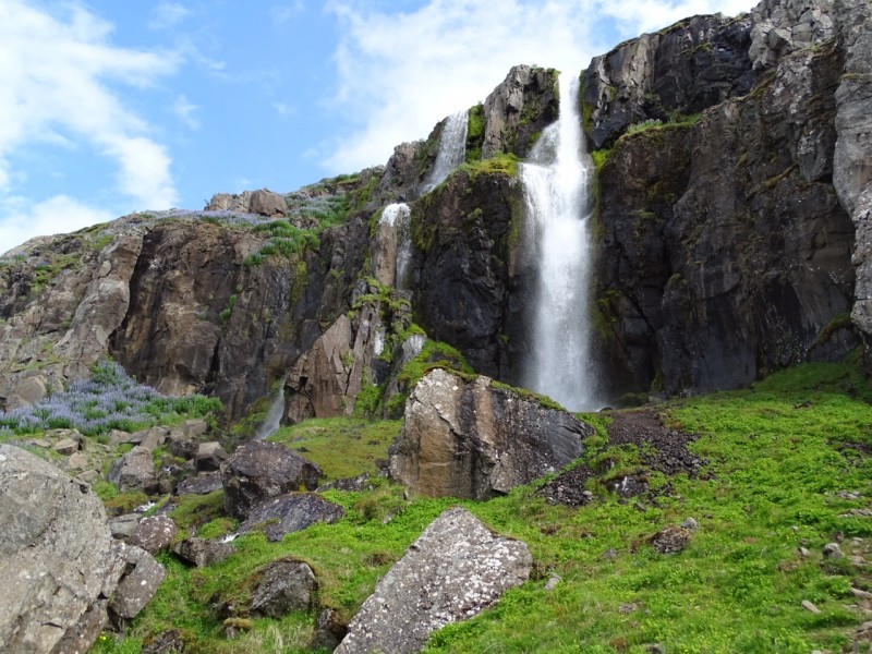
Rather than join them we take our bikes and start looking for a diesel pump, which is quickly found. As we bike on, we see beautiful waterfalls streaming into a river, which in turn flow into a fjord. The melted ice floats on top of the saline seawater. Nature is and remains something stunning to behold. After we return on board it’s time to take a shower and grab the Pilot to see where we’re headed tomorrow. In the meantime a fog bank starts building up. One hour later and we can’t even see the bow, which is completely covered in mist.
18 June 2016, Seydisfjordur – Siglufjordur, 196 miles, cold and foggy
At 09.30 we untie the boat to refuel after a cold night. We call the harbour master who drives up in his old pick-up to fill our tank. After finding the current price on the computer in his office, we join him in driving to the cash machine in town. Payment settled, he drops us back at the yacht and at 10.30 we exit the fjord, looking back at the cycling route we took yesterday.
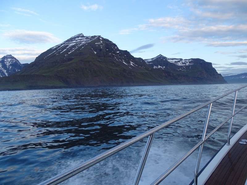
By 13.00 the wind is blowing 25 knots, there are white crests on the waves and our visibility quickly deteriorates. We’re soon enveloped in fog and can see less than half a mile ahead. The area around Reykjanes is known for its fog, which shows up once every four days. It gradually lifts two-and-a-half hours later and the wind picks up. After around five hours on the water we’re finally above the Arctic Circle. Spouts of water are spotted: whales! We quickly change course but so do the whales who soon disappear out of sight altogether.
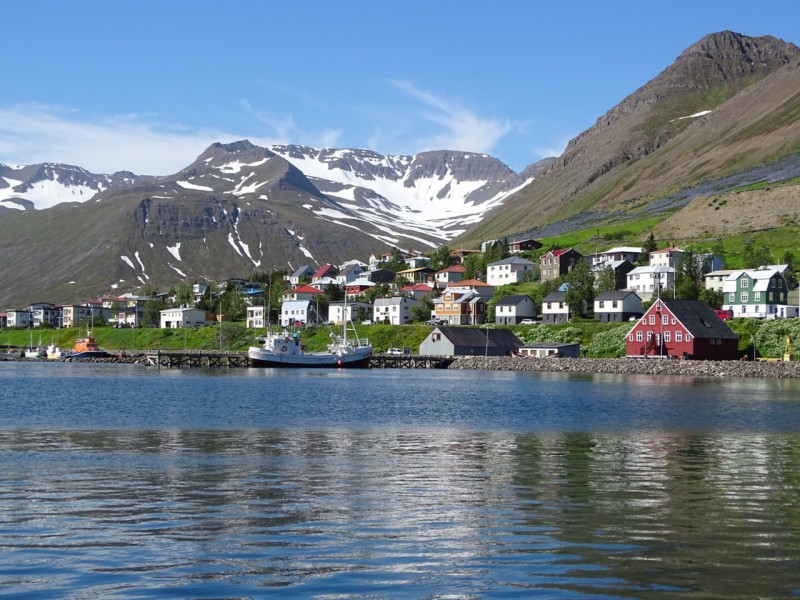
An hour before entering the port of Siglufjordur we have better luck and are able to capture a whale on film. At 12.00, we moor up opposite a quiet and cosy pub. Old photos from the days when the herring industry thrived adorn the walls, as does a brass plate from shipyard De Dageraad Holland. Surprisingly, the Swiss lad sitting beside us speaks excellent Dutch. He tells us he has a Dutch mother, and has been living in Iceland for two years now. Somehow the Netherlands is everywhere.
19 June 2016, Siglufjordur – Isafjordur, 137 miles, cloudless sky
We’re woken at 05.30 the next morning by someone knocking on our door. We’re asked to leave within five minutes because a large vessel is arriving. We consider starting out but soon abandon the idea: we’ve only had 3.5 hours of sleep and could use a couple of hours more. Thankfully, there’s another spot to moor our yacht.
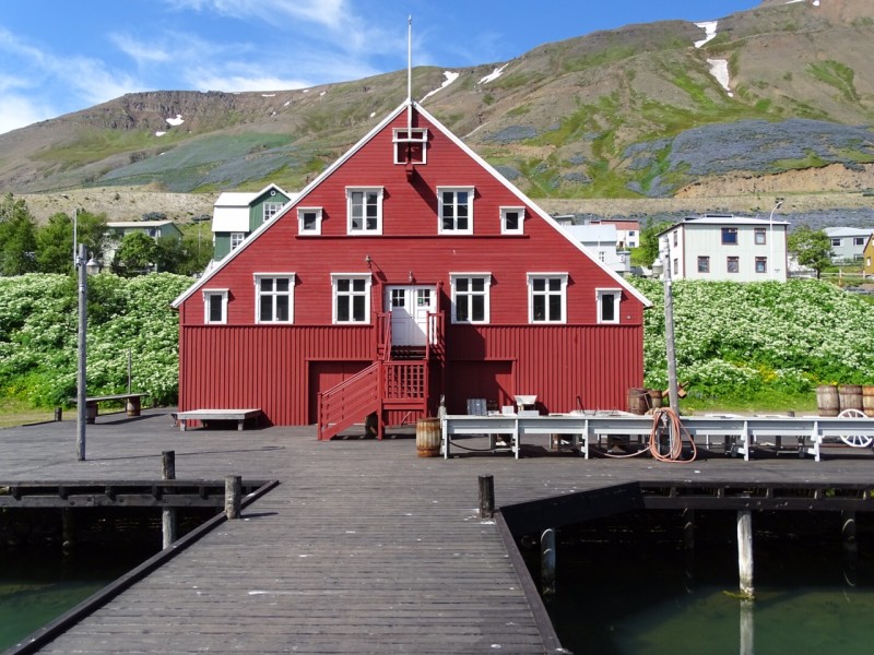
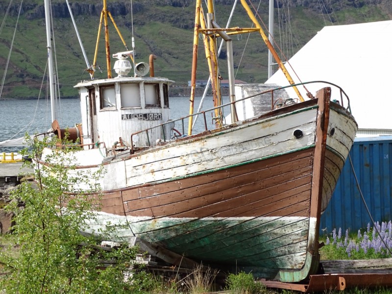
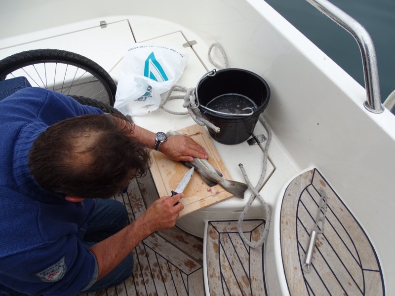
The large vessel is a Purse Seine Vessel and refrigerated trucks go back and forth with their cargo. We manage to get ourselves a fish too: a Greenland halibut weighing around three kilos. Cees filets the fish; part for us and part for fishing. The Pilot indicates that the Herring Museum is worth a visit, and indeed it is. It seems that the oceans were depleted between 1911 and 1968, with photos of fishing boats loaded to the gills with herring showing how. The museum is also home to an old vessel, abandoned some 40 years ago.
(source: site Herring Era museum)
Returning to our boat we start the daily ritual: checking the oil, shining a flashlight through the glass to see if there is sludge in the fuel filters and doing an overall inspection. For the first time in 100 hours of motoring we have to add one litre of oil. When we later asked Cummins they said we’d probably been sailing at some fairly steep angles, causing the engine oil to be sucked up through the sump vent.
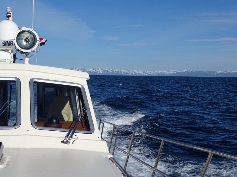
The weather is good, the sea is like a mirror and there’s not a cloud in the sky. The whales return and I take some more photos. Our meal, two large halibut filets, tastes amazing. We take turns sleeping, and when it’s my turn to go on watch I have a great time: snowy mountain tops on the horizon to port, while on the starboard side a sea which seems infinite and a sun that never sets. The sailing is nice and relaxed at 8.5 knots on long swells. We reach the port of Isfjordur at 06.00. In the afternoon we go out on the bikes to see if we can reach the snow. Cees had already spotted a nice, steep road from the cockpit. Eventually we reach an abandoned skiing area and take some photos as proof. We then return on board, enjoy a meal and use our neighbours’ pump to inflate our dinghy. Ours had been left behind in Harlingen… So much for being well prepared!
21 June 2016, Isafjordur – Reykjavik, 180 miles, clear blue skies
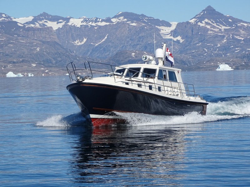
We take the dinghy and slowly cross the fjord, giving us the chance to take some great photos of the North-Line with the snowy mountains in the background. We notice the wind increasing, and suddenly see two whales, one of which shoots out of the water like a torpedo. Not just once, but maybe fifty times: inexhaustible and colossal! Splashing fins on the water, rotating bodies... It all makes for a simply stunning sight. To top it off, several dolphins swim alongside our boat. This is a memory we will always cherish.
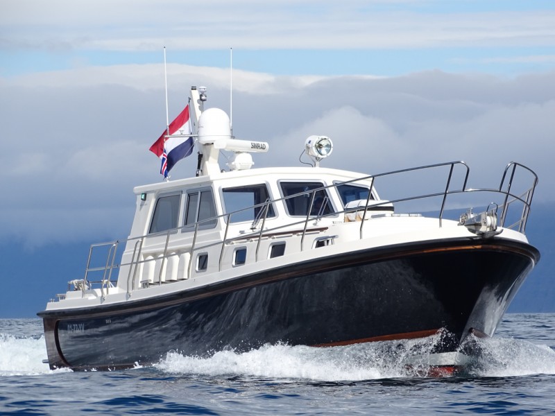
We sail off at an easy 8.5 knots. The sea is getting heavier and some serious rollers pass beneath the yacht. At times we’re lifted around three metres before slowly surfing down the waves at 11 knots. The weather has been in our favour. When we left there was a large high-pressure area south of Iceland, and others told us that it is often at least a few degrees cooler. We sail into a calm night, with the wind and waves receding. We’re still around the Arctic Circle so it is light 24 hours a day: no dark nights for us. Orcas cross in front of the yacht at tremendous speeds. The skies are clear. So clear that we can see the Cape of Snaefellsjökul from 50 miles away, towering 803 metres into the air.
The Arctic Circle is the parallel at 66 ˚30 north latitude. It largely crosses land, contrary to the Antarctic Circle. In Europe it crosses over the northern tip of Iceland, as well as Norway, Sweden, Finland and then over Kola and Siberia in Russia. On the North American continent it traverses Alaska (US) , Canada and Greenland. In principle the area above the circle has several nights around 21 June when the sun doesn’t set, also known as the midnight sun. The farther north one goes, the more nights this involves (source: Wikipedia)
We sleep exceptionally well. Although there is no visual night, our biorhythms are still on track. I get up at 03.30, and Cees goes to bed. The fog appears. It continues to be crucial to keep our eyes peeled even when the AIS says all is ‘safe’. A fishing vessel that has strayed off course passes in front of our yacht. The number of AIS notifications continues to grow; seven so far on the chart plotter. Jill, a North-Line owner, sends a message that we should watch out for the fishing boats. Big brother is watching as we’re closely monitored by Marine Traffic.
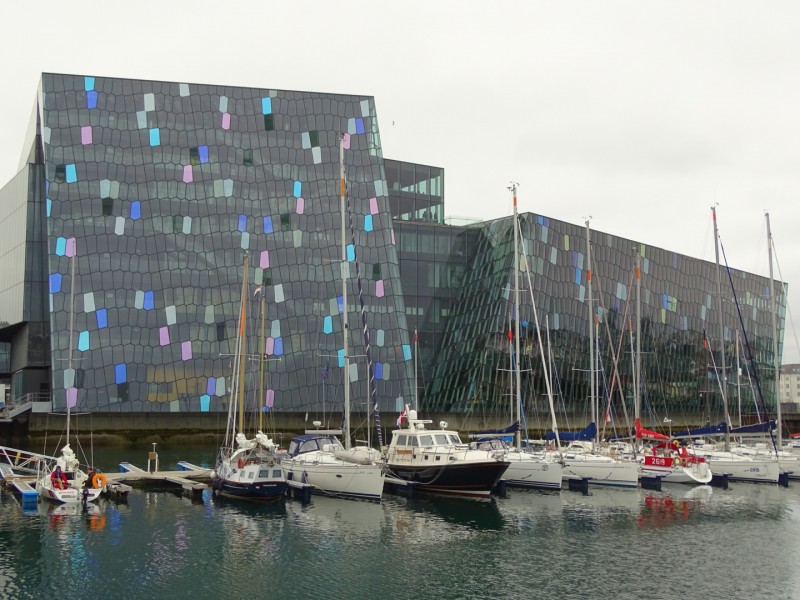
Sailing in the fog is tense: we cross half a mile behind the first fisherman, but can’t see him at all. I change course to avoid a second boat and only see a vague shape in the mist. The others are no risk. Around 11.00 we enter Reykjavik. The fog disappears, and the sun is shining. We moor in a box at the Brokey Yachtclub in front of the prestigious Harpa building.
The champagne is uncorked as we celebrate our arrival. Part one of our mission is accomplished!
23 June 2016, Reykjavik, fog
Today we decide to clean the ship. Tomorrow we fly home for three weeks and I’m feeling nervous about having to leave the yacht behind, unmanned.
While cleaning I think about the times we’ve spent on board. We’ve sailed 1522 miles in two weeks, done a lot of biking and seen many great sights. My ‘backpack’ is filled with experiences and events, my head full of images of the places I have seen. These are things no one can ever take away from me.
The alarm is set for two in the morning and at 03.00 we are on the bus to the airport. I’m going home, but my thoughts are still here for the time being.
15 July 2016, Amsterdam – Reykjavik, sunny
When I hear the intercom at Schiphol say “Last call for Mr. Van Sluis”, I rush to the gate. It is the holiday season and the passport control queues are very long. Thankfully I manage to get to the aircraft on time. We take off for Reykjavik and the Netherlands disappears into the distance: it’s time to bring Dauntless home.
Upon arrival in Reykjavik we’re met by two other North-Line owners who have watched over our yacht for the past few days. Together we drive to the port and find the yacht unharmed and not too dishevelled. Although the Hekla volcano is active, there’s not much volcanic ash on deck. We settle in, have a cup of coffee and then head to the centre to enjoy dinner in a harbour restaurant. After the meal and a walk, we end up in an English pub. Luck is on our side this evening, it seems, because we win eight glasses of beer of our choice playing Wheel of Fortune. Although the live band is good our bunks call out to us. Tomorrow we have an early start.
The next day our first challenge is to find a map of Greenland. The idea that they would be available on every corner appears mistaken. A friendly girl in a shop tries to be of help by offering me a poster of Greenland. We decide to stock up on groceries first. We fill up the car, drive around a bit, and continue asking for a maritime chart. Before we know it, the day has ended and we start preparing for departure. No trip to a glacier for us today; sailing comes first. Four men in an old English Pilot Cutter tell me they experienced some heavy winds out on the water over the previous two days. They recommend a route: better head north and then to Scorebysund. The fjord there is more pristine and easier to enter. We should take into account a greater risk of ice, however, so I should keep an eye on the ice charts. They quickly agree to us copying their maps.
18 July 2016, Reykjavik – Scorebysund (Greenland), 452 miles, mild sunshine, little wind
ClimateGreenland mainly has an arctic climate in the interior and a tundra climate along the coast. In a small strip along the southwest coast, the sea has a mitigating effect. In winter, temperatures can drop down to -50 °C in the interior. In summer it is -10 °C in the interior and 0 to 10 degrees along the coast. On the southwest coast temperatures in summer can sometimes reach 20 °C (source: Wikipedia)
|
After the harbour master has printed another weather report and downloaded the latest ice chart, we leave at 11.45 in the morning. We spend the afternoon in the cockpit on course for Snaefellsjokull, a huge mountain with perennial snow.
.
We can see it 50 miles out but it seems to take forever before we round the mountain. We’re motoring along at eight knots, enjoying the sunshine in the cockpit. At 21.00 we arrive by the Cape and the swell becomes pretty bad: high, steep waves slam into the hull of the yacht. After every seventh wave comes a big dip… And although we changed our course offshore, it’s not until 03.00 that things ease up. But the weather has more surprises for us: incoming fog means we can’t even see our hands in front of our faces! Luckily I manage to avoid a dot on the radar, which we later learn was a sailyacht.
At 11.30 we arrive at Isafjordur and moor at the fuel jetty. The pump attendant recognises me: apparently
I have one of those faces. After refuelling, I ask him whether I can buy a rifle here. Going to Greenland without one would be dangerous because of the polar bears. He feels comfortable lending me one of his own rifles as we’ll be returning a week later. After checking whether this is allowed, we see that we would need a licence if we are to avoid problems with Customs. A second option is to obtain a rifle in Greenland in exchange for a bottle of whisky. A very useful piece of advice!
The fog finally starts clearing up and the wind is increasing. We have to hurry if we want to ensure we don’t spend the entire night in bad weather, but we can’t sail fast: motoring there and back to Greenland plus the fjord is some 700 miles. We won’t make it if we sail at 16 knots, but eight knots gives us a range of 2000 miles. We take turns at the helm. I recognise that I’m a little scared of the polar bears, which might appear out of anywhere.
Thankfully the wind calms down in the morning and the sea is once more like a mirror. Yvette wakes me up as there are three dots on the radar. They turn out to be sleeping whales, and they don’t move when we approach. Not until we change course and back up to take a better look do they dive under water. How large are they? The size of a boat? It’s hard to imagine. The width of the tail looks to be at least four metres. We see occasional spouts of whales greeting us as we pass. The fog is a constant factor. It comes and goes. The first growlers (free-floating chunks of ice) appear on the radar.
My thoughts return to how this adventure first started. Some 25 years ago I read a story about a sailing trip to Iceland. It was a dream for me, but a dream that I would make come true. When building Dauntless I knew she was the yacht that would take me to Iceland. A spectacular journey on the first ever semi-displacement motoryacht to sail from the Netherlands to Iceland at cruising speed without carrying extra fuel. I’d completed the trip many times on my iPad: where can we refuel, which ports do we visit? Cees’ response when I asked him to join us was: “Are you sure? They’re not going to come and get us if something happens, you know!” Yvette and JP were also willing to come on part of the trip. It was a jigsaw puzzle at first but all the pieces came together in the end.
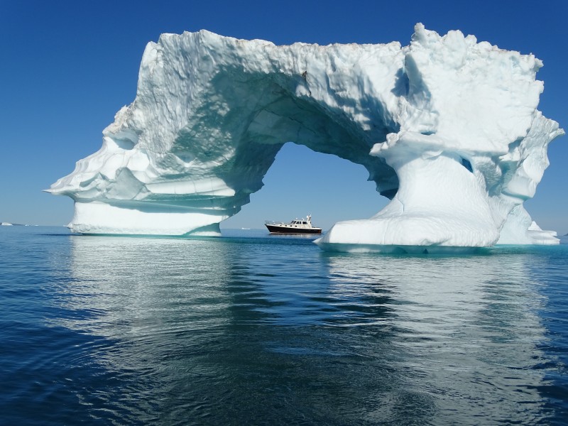
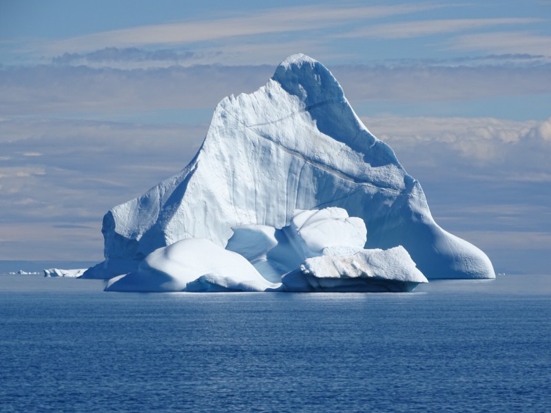
I wake from my thoughts with a start: the first iceberg looms up out of the fog. Like a haunted ship, a grey silhouette drifts by. Now we have to pay close attention: icebergs are treacherous. Not all of them can be seen on radar, but even the smallest ones can do enormous damage. Increasing wind and a broken wind gauge add to the excitement... After rounding Cape Brewster we enter the fjord. The sky turns blue, the fog lifts, and I breathe a sigh of relief.
Behind us we see a great snowy mountain dazzling in the sun. We’ve arrived in Greenland. Distance travelled: 452 miles in 60 hours. We anchor in Amdrup Havn, a bay by the town of Ittoqqortoormiit. Anchoring is difficult as the anchor chain has twisted at sea, and the anchor itself only barely holds in the thick clay on the rocky bottom. Yvette looks at me with a big grin: “You did it! You sailed your own motoryacht to Greenland!” We have a beer to our successful crossing while keeping a close eye on the anchor. At night we take turns checking whether we’ve held position. Heavy katabatic winds roll down the mountain and we can feel the yacht yanking the anchor chain.
21 July 2016, Ittoqqortoormiit – Hekla havn, 93 miles, bright blue skies, sunny
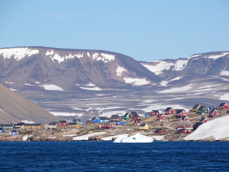
Although still tired, I force myself out of my pit. The weather is agreeable, although chilly at only six degrees. In the cockpit it’s comfortable. The Irish sailors beside us provide various useful tips, like asking for someone called Nils should we need diesel. And so it goes: when we arrive on land with the dinghy we search for Nils and make an appointment with him for the afternoon. This is our chance to explore the town, located in a stunning nature park which is not treated with much respect by the Greenlanders; we see cans and broken glass everywhere. Is it normal here to dump waste in your own garden or on the street?
The weather report is favourable: it looks good for the coming days and 12 to 18 knots is predicted for the weekend. Just perfect! The men at the weather station share the best places to visit. It seems easier for JP to board in Akureyri so Yvette starts rebooking his trip. Walking back down we see a bronze statue of the person who established this village, looking out over sea and wearing a garland. In the supermarket we’re surprised to find rifles for sale beside the milk and eggs; quite a unique product range.
Nils keeps his appointment and arrives in a large bulldozer, which he proudly informs us is the largest in the village. Exactly 498 litres later we pay via a wireless payment device stored in the cabin of the vehicle. That’s modern technology! After taking some pictures of the houses behind us, we sail off gazing in amazement at all that is drifting by. Yvette takes some more great photos from the dinghy and it’s only we when we revisit these images later that we realise how large an iceberg can be.
Early in the morning and some hundred icebergs later we enter Hekla havn, where Lt. Ryder of the Royal Danish Navy overwintered in 1891. We search the coastline with our binoculars and see a hunter’s cabin. Anchored in water ten metres deep and shallow enough to avoid ice, it’s time to enjoy a well-earned tipple.
22 July 2016, Hekla havn – Hekla havn, 28 miles, calm
Mosquitoes, mosquitoes and more mosquitoes. They’re driving us insane so we quickly raise the anchor and sail around the island via Rensund. Lunch is at around 14.00 and then, against all advice, we decide to briefly go on land without a rifle. Back on board we leave through Rensund and eventually return to Hekla havn. We take a look at the hunter’s cabin, and again find lots of waste; a shame on this lovely pebble beach. Back on board we go over tomorrow’s route before heading to bed.
23 July 2016, Hekla havn – Akureyri, 420 miles, calm
The wind picks up to around ten knots and the temperature immediately plummets some five degrees. A passing ice floe makes me turn off the engine. I can see the others wondering what I’m up to. To their surprise I step onto the floe. Yvette circles around it as I take pictures.
After crossing through a minefield of growlers we finally enter more open water with one-metre waves. Four hours later the waves have turned into veritable mountains and the wind has increased to 25 to 30 knots. I start to feel a bit queasy and put on my Crewsaver lifejacket just to be on the safe side. This would be our default action at all times during the trip and we always felt very secure wearing these impressive pieces of gear.
No equipment can spare you from the occasional bout of seasickness though and this kept us up all night. The next day starts with us all in a bad mood, facing high waves and fog. We refuel on the isle of Grimsy just to be on the safe side. We also have something to eat and enjoy a one-hour break. After arriving in Akureyri we notice that the pace of the locals working on a new extension to the quay is considerably slower than anything we’re used to at home! JP joins us after a 14.5 hour flight.
25 July 2016, Akkureyri – Dalvik, 23 miles, low-pressure area, strong wind
While Yvette and JP look around Akureyri I stay on board to reply to some emails, and call Customs for clearance. It is 16.00 before I know it and Customs comes on board. They ask about alcoholic beverages and where we’re from. All in all everything is settled in 20 minutes, and we’re ready to leave for Dalvik at 17.00. Once there we moor between two fishing boats. The weather report indicates that things aren’t going to get much better: there is a low-pressure area above Iceland that will bring strong winds.
26 July 2016, Dalvik – Seydisfjordur, 183 miles, calm to stormy
A new day dawns and the weather seems different: there’s not much wind and all is calm until late afternoon with 20 knots from the north increasing to stormy weather later. I decide to sail to Seydisfjordur in one leg so we safely reach our destination and welcome Cees on board before Yvette and JP depart for their flight on Sunday. The first 100 miles of the total of 190 are the most uncomfortable. Later we enjoy tail winds and it is much easier to move around and use the toilet. Once we arrive in Seydisfjordur we moor at the same quay as several weeks ago. The yacht pulls on the lines and the wind howls.
27 July 2016, Seydisfjordur
We take out our fishing gear and throw out a line. We catch a nice flounder not much later, and a small wolf fish too, but no further luck. Not enough for dinner. Time for other activities: we clean the bikes and yacht, and oil our bicycle chains. I decide to take a short cycling trip. It’s chilly at six degrees, so the coffee tastes especially good when I return on board. We learn that one of Yvette’s colleagues is only 25 kilometres from where we are. Half an hour later, the family steps on board and we exchange stories and experiences.
28 July 2016, Seydisfjordur, strong wind
Today is a lazy day, and we’re relieved that we decided to sail here in one go: sleeping in, doing chores, biking around, cooking and the day has already come to an end.
29 July 2016, Seydisfjordur
A great day for fishing. First we sail through the fjord with the paravane behind us, and later we try using our rods. No luck... the fish aren’t biting.
|
The paravane is fishing gear that is towed behind a boat. It consists of a tug line, a small board and a fishing line. When you lower the board on the tug line into the water, it disappears under the water at low speeds due to its slanting front. The fishing line connected to the back therefore also disappears under water making it an easy way to catch fish (source: Wikipedia) |
Back on board we refuel some diesel for the return journey. The harbour master arrives five minutes later, looking smart in a nice suit jacket. He apologises for his attire; he had just come from a funeral. Once refuelling is complete and I’ve paid in the village, the harbour master returns me to ship.
30 July 2016, Seydisfjordur
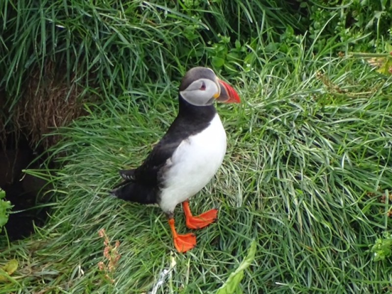
Hitch-hiking to Egilstadur to rent a car, which will allow us to explore and pick up Cees from the airport at night. We quickly get a lift and I’m immediately asked whether I’m the man from the ‘blue motorboat’. The driver is curious about our travels and drops me off right at the rental point. What a service! Once we have our car we decide to drive to Hofn to look at the puffins.
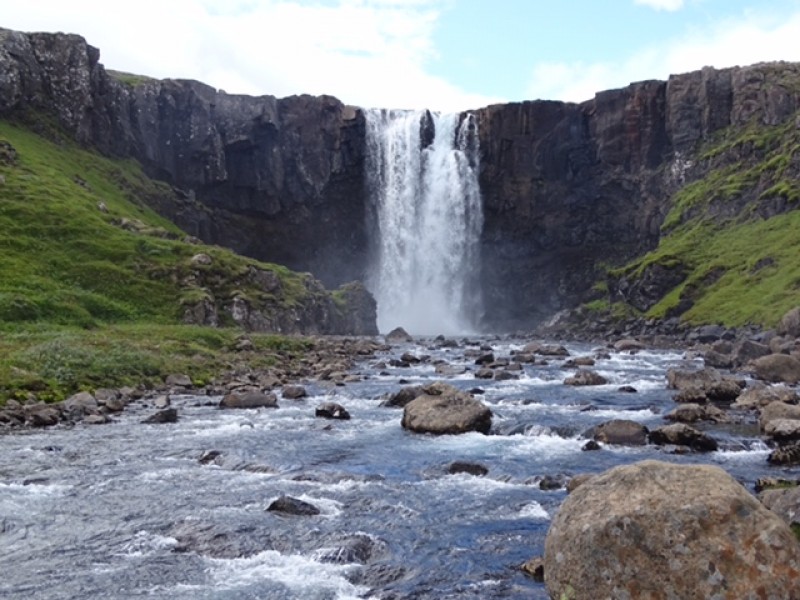
We are not the only ones: the local pub is full of puffin watchers. They’re dressed in expensive outdoor gear and hiking boots and we feel awkward in our jeans, winter coats and boat shoes. The puffins don’t seem to care what people are wearing though. After taking a few pictures we drive on to a large waterfall via a beautiful route along a lake and through a forest. From the waterfall we hike 2.5 kilometres before heading back to the car and driving to the airport to pick up Cees.
31 July 2016, Seydisfjordur – Midagur Faeroe Islands, 285 miles, windy
We prepare the boat for sailing and check the weather before we leave. We know we can expect wind but decide to leave anyway as the weather seems likely to deteriorate further later in the week. Exiting the fjord we face wind force 4 from the north and a swell of around three metres. The swell is long, so motoring isn’t too difficult. In the evening the wind increases and the waves occasionally exceed five metres. 100 miles before the Faroes we change course to the westernmost island. We are happy to arrive in Midagur in the afternoon: the last couple of hours haven’t been much fun. A plate of fried rice works wonders and we head to our bunks not much later.
1 August 2016, Midagur – Kirkwall, 241 miles, low-pressure area
After leaving Midagur we go shopping in Torshavn and I try to get a haircut at the local barbers: he’s busy, unfortunately. Back on board we feel a little uneasy: the plan to sail 30 miles to the southernmost island and from there to the Shetlands would mean crossing through a low-pressure area with winds from the east in the northern segment and western winds over the Orkney islands. We decide on Kirkwall. With a plate of pasta on our laps, Cees and I decide it’s good: eight knots and chugging along slowly. We take turns sleeping again. At the end of the night we need to speed up to ensure we reach the islands at the right tide. We see land in the early morning and sail through the Westray on a good current. It is 07.30, time for eggs and bacon, real seaman’s fare! We take out the bikes to explore the town and its lovely church.
3 August 2016, Kirkwall – Peterhead, 105 miles, low wind
After departure we shut off our engines almost immediately and throw out the fishing lines. Maybe this time we’ll succeed in catching our own meal. Only five minutes later Cees feels a tug on the line; a mackerel first and then a ling.
|
The ling (Molva molva) is a cod-like fish (Gadiformes), member of the Lotidae family, that lives in the northwest and northeast of the Atlantic Ocean, the North Sea and the Mediterranean (source: Wikipedia) |
Ling can reach lengths of up to three metres and the one we catch is much smaller, though we’re still very pleased with ourselves. At 21.30 we start the engines and head toward Peterhead: little wind, few waves. We take it easy and take turns sleeping for a few hours. Because the nights are getting darker, our rhythms are improving. The soft motion of the yacht rocks me straight to sleep. We sail into Peterhead at 08.00, and busy ourselves with the hose of the washer and the water lock. The machine isn’t getting any water and the lock is wet. Out on the bikes we go to find some new parts and end up taking a wrong turn! Eventually we have to use a hose without a lock, but at least we can wash our clothes. The weather is less positive: while shopping it starts to drizzle. In addition, the handles of our shopping bag break and we have to carry everything in our arms.
4 August 2016 Peterhead – Thyboron, 337 miles, calm and sunny
Setting off at 11.00, the weather is calm and the sun is out. We sail at a relaxed pace of 17 knots, and take turns napping. We wouldn’t have been this relaxed if we’d known what the weather had in store for us later: the wind would become much stronger in the night and we literally rolled into Thyboron. Our German neighbour in the port is impressed when we tell her about our travels. We help untie her boat and say goodbye with a ‘Gute Fahrt’. The port celebrations in Thyboron are in full swing. We pass stands with knick-knacks and take our time strolling around, eating some fabulous fish & chips and checking out a few fishing boats. One of them motors out at night and we watch her depart into the heavy waves.
6 August 2016, Thyboron – Grenaa, 136 miles, rainy
Because we need to take on diesel we sail through the Limfjord towards Aalborg. Unfortunately you have to have a special card to refuel here. The rain is heavy and we’ve switched on the radar. A bridge attendant shouts that we can easily pass beneath the first bridge. He’s right and we continue onwards. Cees prepares another lovely meal and, after the sun has gone down, we sail from Aalbord to the Baltic Sea. The sea is uncomfortable and we bash straight into it. Upon arrival we enjoy a beer and go to bed early. The next day we’re off bright and early as the wind is due to increase later in the day.
7 August 2016, Grenaa – Aerosund, 93 miles, strong wind
The wind makes departure tricky. The waves are heavy and we switch back to ten knots. There’s nothing fun about this kind of motoring so we decide to moor in the marina in Aero and have a meal at the ‘fiskershus’, which looked inviting from the outside, but is strangely sterile within. For a moment it’s like we are in a football cafeteria on a Sunday afternoon. The food is tasteless but arrives quickly. We prefer to have our coffee in the adjacent hotel where I look around with envy at people tucking into some delicious looking fish dishes. A glass of whisky offers some consolation.
8 August 2016, Aerosund – Cuxhaven, 130 miles, not much sun
While unmooring there is very little wind and the sun is trying to break through. We arrive in Kiel after four hours. And we’re in luck: the locks are opening and we can sail right in. A neighbour tells me that we no longer have to pay: apparently that would entail climbing a few steps and last year someone fell on them so they were deemed too dangerous.
Once we exit the locks we sail eight hours to Brunsbüttel. Lady Luck is on our side again: the locks are open and we can continue on. Because the wind has died down we seriously consider continuing to Helgoland. With Cuxhaven one mile behind us the wind picks up and the sea becomes tumultuous. We decide to turn around: we’ve travelled plenty for one day. Two Dutchmen hear of our journey and the admiration and surprise in their faces is clear to see. I guess it’s pretty cool to say that you’ve ‘just’ sailed to Greenland and Iceland.
9 August 2016, Cuxhaven – Borkum, 100 miles, strong wind, high waves
|
The German island of Borkum is the westernmost and largest of the East Frisian Wadden Islands. It is situated off the coast from the Dutch province of Groningen and is part of the landkreis Leer in East Frisia in Niedersachsen. It is slightly smaller than Schiermonnikoog, the smallest inhabited Dutch Wadden Island. According to data from the Landesbetrieb für Statistik und Kommunikationstechnologie Niedersachsen it totalled 5266 residents on 31 December 2008 (Source: Wikipedia)
|
The water gets worse and worse as we bounce on the waves: this is not much fun. For a moment we consider heading onto the Wezer (the largest river originating and ending in Germany), but it’s not really an option. Once we’re above Norderney I’m afraid to head inward as both the winds and the waves have increased. We decide to continue to Borkum. Above the island we see a fishing boat exit through the Riffgat which gives us the courage to go in. The chart says there is six metres of water, so if the fishing vessel can do it... It feels like we are surfing. I steer by hand, afraid that the autopilot won’t be able to keep up. Bathed in cold sweat we hurtle in and quickly reach deeper waters. Relieved we tie up to the quay and treat ourselves to a proper meal in a good restaurant: flounder with sorbet as dessert. The last supper: tomorrow we’ll be home.
10 August 2016, Borkum – Harlingen, 114 miles, receding wind
The wind has receded somewhat and is now coming from the southwest. We set out via the Hubertgat and continue just below the islands on the ten-metre line. At 11.00 we are right on time for the tide change at the Stortemelk. On the considerable swell we bounce inward, take a shortcut by the Richel and pass through the Vlieree at 20 knots. I reminisce about the journey that has now almost come to an end. I have realised my dream, fulfilled my wish. It starts to drizzle. Almost home.
We sailed for six weeks, traversed 4300 nautical miles, and ran 390 engine hours. The yacht has more than proven herself and performed well in all conditions. In that sense Dauntless fulfils her promise: dauntless, fearless, daring.
All I can think is that ‘dreams can come true’.
Sipko van Sluis, owner North-Line Yachts